Is Bahía Kino worth the drive from Hermosillo? It’s less than an hour west of Hermosillo, toward the Sea of Cortez: giant cactus and brilliant blue water.
The area was explored by the mapmaker Padre Eusebio Kino in 1685, and it stayed a tiny fishing village until the road from Hermosillo was paved in 1953. About 7,000 people live here now.
Bahía Kino is a tale of two towns. Old Kino has the older commercial area. Nuevo Kino, to the north, is a large swath of small hotels, RV parks and small restaurants. Don’t miss the unique Seris Museum.
A magical village. Have you been to Bahía Kino? Which side do you prefer, Old Kino or Nuevo Kino? Tell us in the comments.
Huatabampito, Sonora is a seaside beach on the Sea of Cortez: undeveloped, raw Sonoran beach, about an hour off Highway 15 from Navojoa.
You get 20 km of beautiful flat sandy beach, a few motels, an RV park and restaurants, and fresh fish and shrimp. We bought shrimp the size of a small banana.
Many locals drive on the beach. Be careful: more than one vehicle has gotten stuck in the sand.
Big water. Big beach. Big sky. Have you camped or stayed at Huatabampito? Tell us what you found in the comments.
Kilometer 21 (Km 21) on Federal Highway 15, about 21 km south of Nogales, is where you get your tourist visa (INM) and your vehicle permit (Banjercito). The old customs inspection checkpoint at KM 21 closed in 2014.
It can be confusing, because the offices sit just south of the KM 256 sign. Make a right turn into the driveway. Walk to the Tourist Visa office and get your visa. Ten feet away, inside, is the copy kiosk where you can get the copies you need. Then continue to Banjercito to get your vehicle permit.
Get your papers and start your amazing road trip here. Have you been through KM 21? Any tips for first-timers? Tell us in the comments.
If you’re driving south from Nogales, Navojoa, Sonora is often the first night stop on the way to the resort areas further south. It’s about a 7-hour drive (377 miles / 600 km) from the border, which makes for a long day.
Motels and hotels are easy to reach whether you’re coming from the north or the south, and many have large lots that can handle RVs.
Navojoa is an agricultural center with excellent restaurants and eateries. It’s also a great jumping-off point if you’re heading to Alamos, or out to Huatabampo and Huatabampito on the West Coast.
A wonderful night stop on a magical road trip. Have you stopped in Navojoa? Where do you like to spend your first night south of the border? Tell us in the comments.
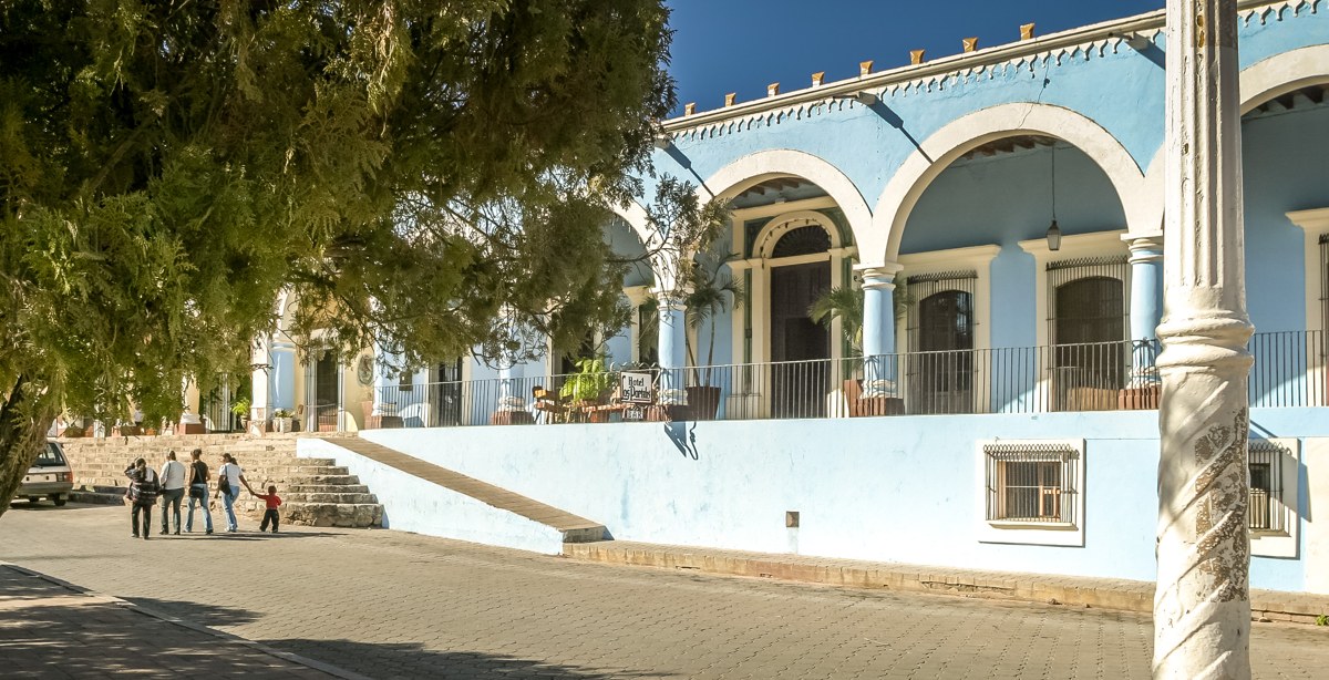
If you’re driving Highway 15 and looking for something different, Alamos is a wonderful stop on a magical road trip. It’s a unique, historic side trip, and it doesn’t take long to reach.
The drive to Navojoa is 377 miles (605 km), about 6½ hours. From there you head east on Highway 162 for less than an hour.
Alamos began as a silver mining city in the late 1600s. It flourished and became the wealthiest city in the area, a hub for social, financial and cultural life. That money built grand mansions, haciendas and other historic buildings, and many of them are still standing around the plaza.
These days it’s a quiet, peaceful spot. Walk the city center, visit the museum, browse the souvenir shops, and let your imagination run wild.
Alamos is one of those side trips that makes a Highway 15 drive more than just getting from A to B. Have a look at our other road-trip stories for more ideas.
Have you made the side trip to Alamos, or always stayed on Highway 15? Tell us what you found in the comments.
Photography by Bill Bell. Produced by Dorothy Bell.
Music: “Soft Mexican Guitar” by Kevin Llanes (Drippeados), via Pixabay.
Most people driving Highway 15 south to the beach towns never set foot in Hermosillo. The new ring road makes it easy to bypass the capital of Sonora altogether, and for years that’s exactly what a lot of travellers do.
That’s a mistake. Hermosillo is Sonora’s largest city, with close to a million people and a real industrial base built in part on auto manufacturing. It also earns its nickname honestly — locals call it the City of Sun, and from May through November the highs routinely clear 45°C.
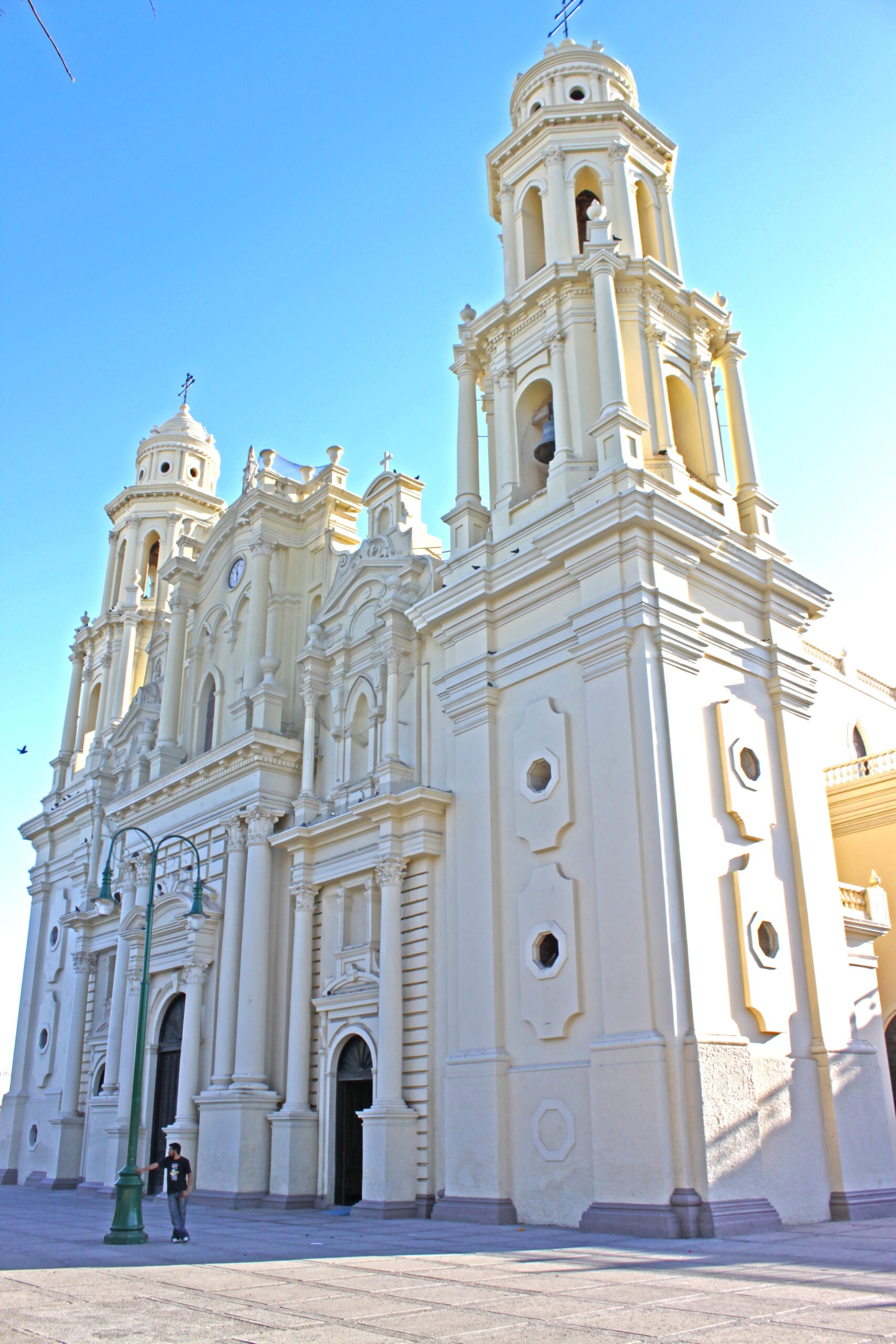
None of that matters once you’re standing in the historic center. The main square is lined with handsome colonial buildings, the Cathedral of the Assumption of the Blessed Virgin Mary dominates the skyline, and the restaurants serve some of the best Sonoran cooking you’ll find anywhere in the state.
From Nogales it’s a straightforward drive — about 3½ hours, 178 miles or 286 km — so it’s an easy add to any trip down the coast.
Have you driven through Hermosillo, or always bypassed it on the cuota? Let us know in the comments.
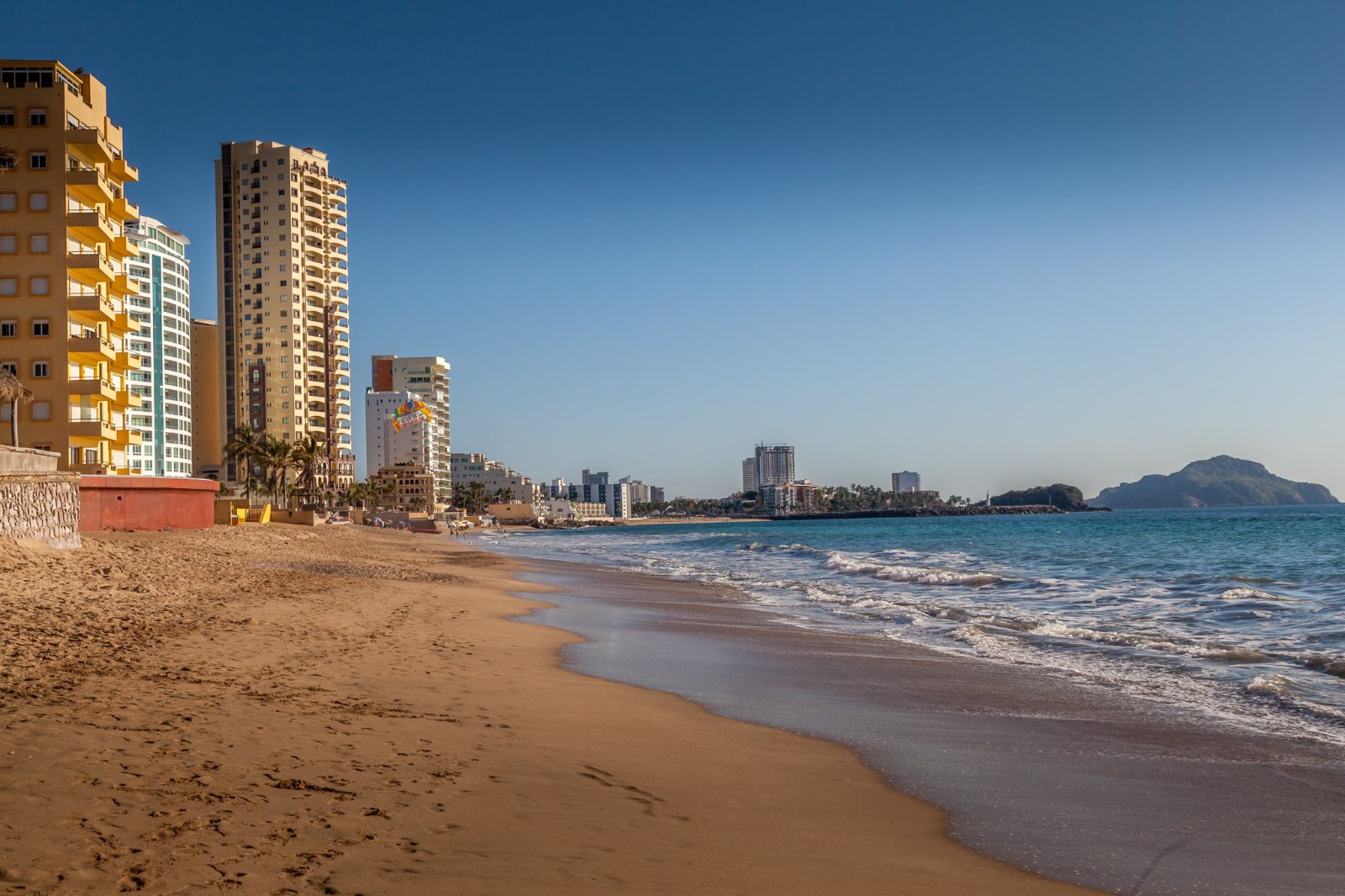
Mazatlán is the kind of place that makes you put the camera down long enough to order lunch, then pick it straight back up again. Sandy beaches, a working waterfront, music drifting across the sand and a historic downtown with plenty of character: there is a lot here beyond the resort strip.
Mazatlán in 60 seconds
Take a quick trip through Bill Bell’s photographs, from the Pacific shoreline and the city’s familiar pulmonía taxis to the José María Pino Suárez Market. This reel uses music and on-screen text, so you can enjoy the story with or without sound.
Mazatlán in 60 seconds · Photography by Bill Bell
More than a beach town
Mazatlán’s name means “Place of the Deer.” Just south of the Tropic of Cancer, this Sinaloa port brings together beach holidays and the everyday life of a coastal city. Leave time for the historic centre, a seafood meal and a stroll along the waterfront.
There is history behind the holiday atmosphere. Indigenous communities lived in the region before the Spanish arrived in the 1500s. German brewers founded Pacífico in 1900, and banda music is part of the sound of Sinaloa. The city’s Carnaval tradition adds another reason to return.
Make it part of the journey
Mazatlán makes a memorable stop on a west-coast Mexico road trip. Beaches and hotels are only part of the appeal; give yourself time to explore downtown and enjoy the food. If your journey continues across the water, check Baja Ferries for current routes and vehicle arrangements before planning your crossing.
Drive Mexico – Extraordinary Road Travel Photography by Bill Bell.
Music: “Mexico – Mexican Mariachi Music” by IKOLIKS, via Pixabay.
San Carlos sits on the Sea of Cortez just outside Guaymas, in Sonora — one of our favourite overnight stops when we’re heading south on Mex 15.
It started as a planned beach community, and today about 3,000 people call it home — a number that swells past 7,000 once the winter snowbirds roll in. The bays here are clear and shallow, which is why San Carlos has become such a draw for swimming, scuba diving, fishing, boating and sailing.
Summers are hot and humid. Winters are the opposite — mild enough that RV parks, hotels and resorts fill up with Canadians and Americans escaping the cold.
Watching over all of it is Tetakawi Hill, a jagged double peak the Yaqui called the “broken mountain.” Locals have their own, more colourful name for it in Spanish.
San Carlos is just 5-6 hours — about 400 km — south of the Arizona border on Mex 15, which makes it a natural first-night stop if you’re driving into Mexico. We’ve stayed here more times than we can count.
Watch the full 60-second reel above, and if you’re planning your own drive south, we’ve got guides to Mexican auto insurance, border crossings and road conditions right here on the site.
Have you stopped in San Carlos on your way south? Tell us in the comments.
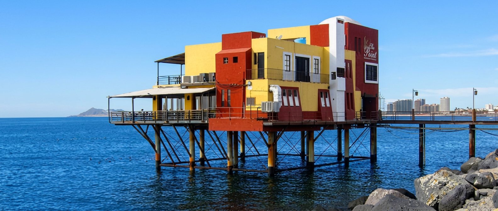
Rocky Point sits at the north end of the Sea of Cortez, where the Sonoran Desert runs straight into the water – and depending who you ask, it’s either a quiet fishing town, a spring-break institution, or Arizona’s unofficial beach. All three are true at once.
A Legend Built on Bootlegging
Local legend has it that Al Capone built a casino, a water well, an airport, and a dock in Puerto Peñasco in the 1920s to help run his bootlegging operations across the border. It’s one of those stories that’s been repeated so often around town it’s practically civic history – except nobody has ever produced the paperwork to prove Capone was ever actually there. True or not, it fits: Prohibition-era America needed somewhere close, and Puerto Peñasco was about as close as it got.
From Fishing Camp to Arizona’s Beach
Whatever kicked it off, the infrastructure boom that followed – roads, an airstrip, a working port – is what turned a fishing camp into a real town. Puerto Peñasco has been drawing Americans across the border ever since, helped along by a detail every Arizona teenager eventually learns: Mexico’s drinking age is 18, not 21. For decades that’s made it a favorite weekend and spring-break escape for visitors from Tucson and Phoenix, who are actually closer to this stretch of Mexican coast than they are to Hermosillo or Mexicali, the nearest Mexican cities in the other direction.
The Point That Gave It Its Name
Peñasco means “big rock” in Spanish, and the rocky point the town is built around is exactly that – a headland jutting into the Sea of Cortez that gave the place both its Mexican name and its English nickname, Rocky Point. Walk out to it and you get the whole town in one view: the malecón, the fishing fleet, and well over a hundred kilometers of beach running off in both directions.
The Video
Photography by Bill Bell. Produced by Dorothy Bell.
Planning to drive down yourself? We’ve laid out the logistics – the border crossing, what permit you actually need for a Sonora-only trip (and the one you don’t), and where to stay – over on our sister site: Visiting Puerto Peñasco: The Logistics.
Bootlegger’s legend aside, is it the beach, the history, or the drinking age that keeps pulling people back to Rocky Point?
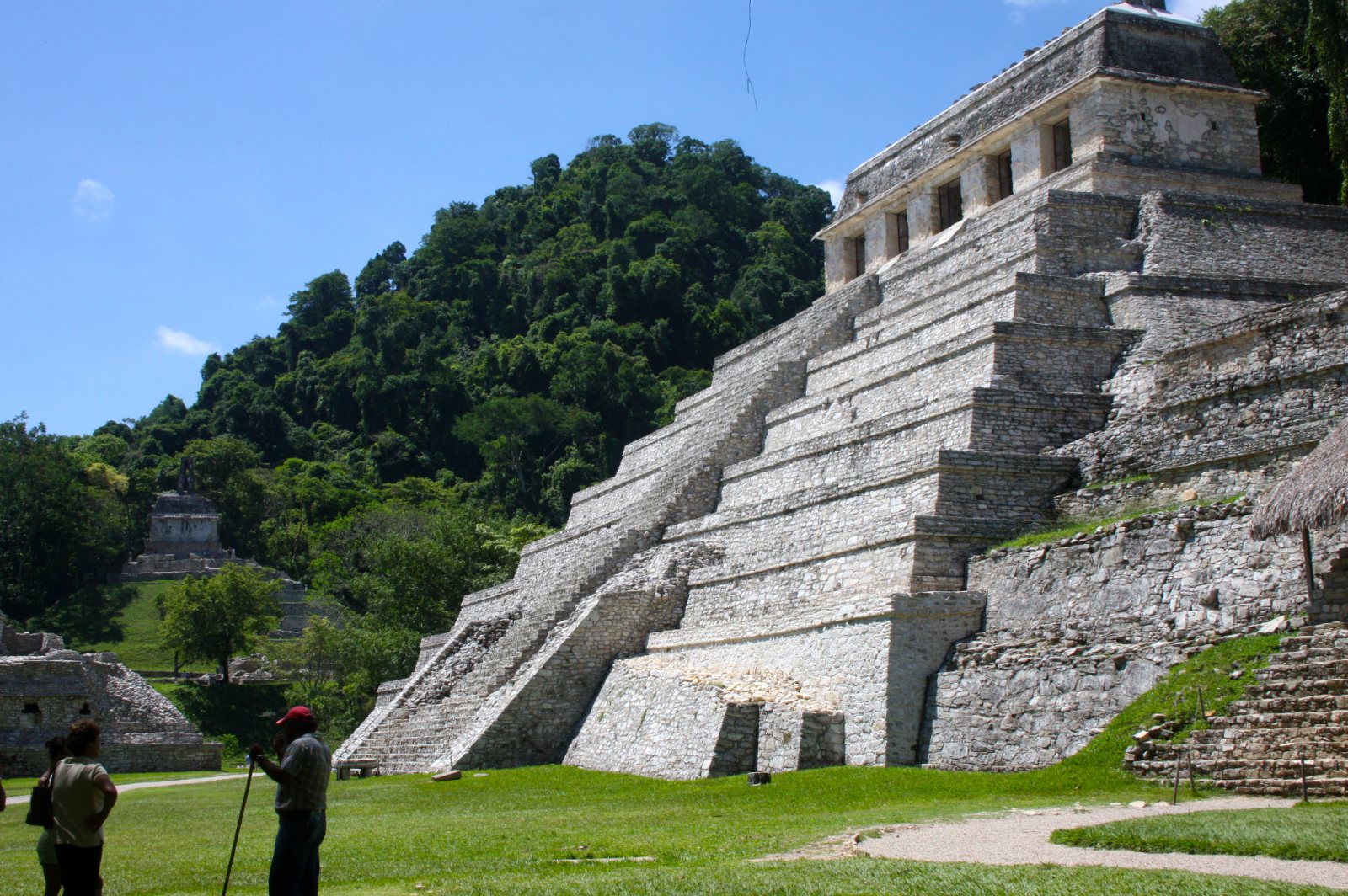
Most Maya sites make you imagine the jungle that used to surround them. At Palenque, you don’t have to imagine it – it’s still there, closing in right at the edge of the plazas, with the calls of howler monkeys carrying over the ruins most mornings.
A King Crowned at Twelve
Palenque’s story is really the story of one man: K’inich Janaab’ Pakal, who took the throne at age twelve after the city had been badly beaten down by its rival Calakmul, and then ruled for 68 years. Nearly everything visitors see today – the Palace, the temples, the astronomical alignments built into the architecture – dates from his reign or his son’s. He didn’t just rebuild a defeated city. He turned it into one that, by the accounts left behind, eclipsed even Tikal.
What Was Found Inside the Temple of Inscriptions
Pakal’s funerary temple is the site’s centerpiece, and for a good reason: in 1952, archaeologist Alberto Ruz Lhuillier climbed down a hidden staircase sealed for over a thousand years and found Pakal’s tomb waiting exactly as it had been left – jade mask, jade jewelry, and a carved sarcophagus lid whose imagery has been endlessly (and wrongly, per mainstream archaeology) reinterpreted online as depicting an astronaut. It isn’t. It’s a king falling into the underworld to be reborn, straight out of Maya cosmology. It’s still one of the richest royal burials ever found anywhere in the Americas.
Why It Went Quiet
By around 799 AD, Palenque was abandoned, part of the broader collapse that hit Maya cities across the region. The jungle did the rest, swallowing the site so completely that Spanish explorers who stumbled onto it in the 1520s barely registered what they’d found. Serious excavation didn’t start until 1773, and the tomb itself sat undiscovered for another 180 years after that.
The Video
Photography by Bill Bell. Produced by Dorothy Bell.
Planning to drive there yourself? We’ve laid out the logistics – the drive in, hours and admission, and the Highway 199 safety note – over on our sister site: Visiting Palenque: The Logistics.
Between the setting and the history, Palenque tends to hit people differently than the more open sites like Chichén Itzá or Uxmal. What was your reaction the first time you stood in front of it?