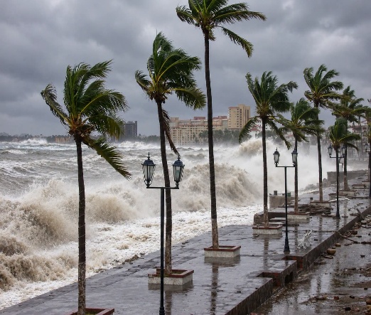
Above: Coastal waves during stormy weather. Image supplied with the original article; location and date unspecified.
JALTEMBA BAY, NAYARIT — For residents and visitors in Los Ayala, Rincón de Guayabitos and La Peñita de Jaltemba, preparing for a tropical storm starts with decisions made before the rain: where to go, what to take and how to keep in touch if electricity or mobile service fails.
Spears, who describes three decades of living in coastal communities, encourages people to replace anxiety with preparation. That is a useful starting point for Jaltemba Bay, where a household plan can also help visiting relatives, seasonal residents and neighbours who need assistance.
This is a preparedness feature, not a current storm warning or beach-closure announcement. Check the latest official notices before travelling or entering the water.
A sheltered-looking bay still needs a storm plan
Living beside a bay does not guarantee protection from hurricane winds, dangerous surf or rising water. A storm’s track, size and intensity, along with the shape of the coast and seabed, influence its effects. Do not assume that an offshore storm will leave your neighbourhood safe.
Storm surge is seawater pushed above the normally expected tide. Combined with tides and waves, it can flood coastal areas and move inland along rivers and canals. Heavy rainfall brings a separate flooding risk. The National Hurricane Center’s storm-surge explanation describes why the danger extends beyond the beachfront.

Prepare the household before conditions deteriorate
Choose a safe destination and discuss how everyone will get there if authorities order an evacuation. Ask your hotel, rental host or campground manager about the property’s emergency arrangements. Make plans for children, older neighbours, people with limited mobility and pets before transport becomes difficult.
- Keep drinking water, food that needs little preparation and essential medicines ready.
- Pack a torch, spare batteries, a battery-powered radio, a charged phone and a power bank.
- Protect identification, prescriptions and important documents in a waterproof bag; keep accessible copies.
- Have some cash, practical footwear and pet supplies ready to take with you.
- Agree on a family contact and meeting place, and write down key numbers in case your phone is unavailable.
Mexico’s CENAPRED publishes guidance on packing an emergency bag. Keep yours somewhere easy to reach, rather than waiting for an evacuation announcement to assemble it.
Beach and road decisions matter

Follow lifeguards’ instructions and posted beach restrictions. If a red flag or closure prohibits entering the water, stay out even when the sea looks calm. Avoid waterfront walks to watch large waves.
Drivers should never attempt to cross a flooded road or flowing arroyo. Water can conceal a washed-out road surface, and conditions can change faster than a driver can react. Turn around at flooding or a barricade and follow official route advice. The National Weather Service’s tropical-weather preparedness guidance reinforces that precaution.
For an RV trip, establish where you can move to a suitable safe building if necessary. Avoid leaving a coastal departure until severe weather is already affecting the route.
Use current local instructions
Follow Servicio Meteorológico Nacional and CONAGUA forecasts, together with Nayarit and municipal Protección Civil notices. Mexico’s Preparados portal provides civil-protection resources and links to temporary-shelter information. Confirm with local authorities which shelter is open, how to reach it and whether it can accommodate your household’s needs.
Old shelter lists and undated social-media warnings can cause confusion. Check the date, location and issuing authority before sharing an alert. Obey evacuation instructions promptly.
For Jaltemba Bay, the practical message is simple: make the plan while there is time to think clearly, help neighbours prepare, and let official instructions guide your next move.