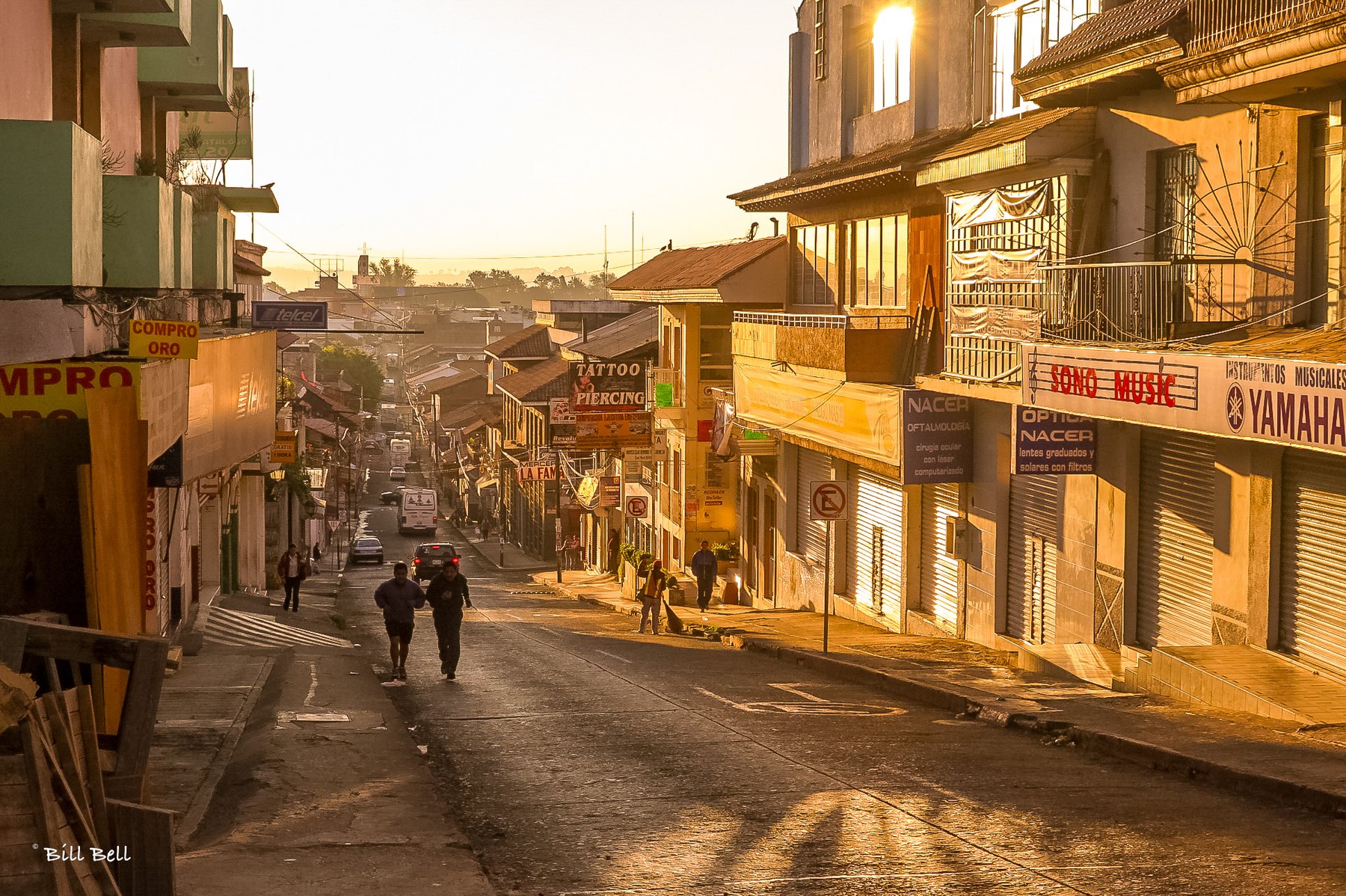
A cool mountain escape from the hot Michoacán coast
Uruapan is off the beaten track right now. Government travel warnings have put much of Michoacán off the list for many travellers, and we’d urge you to check current advisories before you plan anything. But Dorothy and I drove up from Zihuatanejo in 2007, on the main route, and after the hot, muggy Michoacán coast, this mountain town was a welcome respite.
Where it is
Uruapan sits in the highlands of western Michoacán, about 1,600 metres (over 5,000 feet) above sea level. That elevation explains the relief. After days of coastal heat, the air up here is cool and fresh, especially in the early morning, when the light turns the streets gold. The drive inland from the Pacific climbs steadily into the mountains, and you can feel the temperature drop as you go.
It’s roughly an hour’s drive from Pátzcuaro and about two hours from Morelia, the state capital.
A little history
The Spanish founded the town in 1533, when the Franciscan friar Juan de San Miguel laid out its first neighbourhoods. The name’s origin is debated, but the town has long been green and fertile.
Franciscan influence shaped Uruapan’s early years, and you can still see it in the old churches and chapels around the centre.
Uruapan is also famous for avocados. The surrounding hills produce a large share of Mexico’s crop, and the town is often called the avocado capital of the world. The volcano Paricutín, which rose from a farmer’s field in 1943, is a short drive away.

One of the town’s best-known landmarks is the Templo de la Inmaculada Concepción, also known as “El Templo Nuevo,” in the centre of Uruapan. Its white façade is framed in pink stone, with angels along the roofline and a clock tower above the door. It sits on a busy corner where trucks, taxis and street sweepers go about their morning.

What we saw
We spent our time on foot, starting early. The central plaza is shaded by huge old trees with whitewashed trunks, and green iron benches, a fountain and monuments fill the space.

Under the arcades on its edge, hanging ferns and old lanterns line the walkway, and schoolkids in uniform hurry past in the morning light.

Wander the streets nearby and you’ll find a working Mexican town, not a tourist set: shuttered shops waiting to open, a street sweeper at work, joggers climbing the hill, and signs for everything from music stores to eye clinics.

Statues and sculpture dot the plaza. A stone eagle with a snake, Mexico’s national emblem, perches above one corner.


Worth knowing
- The park. The Barranca del Cupatitzio National Park is Uruapan’s best-known sight, with a river running through shady forest.
- Crafts. Michoacán is known for lacquerware and woodwork, and Uruapan is a good place to look for both.
- Weather. It’s much cooler than the coast, so bring a light layer for mornings and evenings. The rainy season runs roughly June to October.
- Safety. Conditions in Michoacán can change. Check the latest government advisories for your home country, stick to main toll highways in daylight, and plan your stops in advance.
Our take
Uruapan isn’t on most itineraries right now, and that’s part of why we remember it. We’d go back when conditions allow.
Planning a Mexico road trip? See our current road reports, routes and Mexican vehicle insurance, and browse more destinations.
Have you been to Uruapan? Tell us in the comments.
Photography by Bill Bell.